
Spatial Reference Information System | Geological Hazards
A Spatially Referenced Information System for managing geological hazards in the canton of Valais
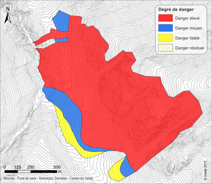
SIRS-DAGEO is one of the spatially referenced information systems (SIRS) set up by the canton of Valais to optimize the use and development of information contained in natural hazard studies (avalanches, floods, ground instabilities). SIRS-DAGEO records information relating to geological hazards.
Launched by the canton of Valais in 2004, SIRS-DAGEO enables data from geological hazard studies to be exploited. It was developed on the initiative of the Service des dangers naturels(SDANA), in collaboration with the Centre de compétence géomatique(CCGeo) and CREALP.
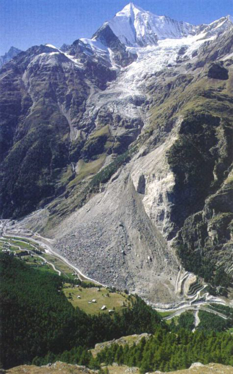
Hazards due to ground movements include falling processes (rock and boulder falls, rockfalls, collapses), sliding processes (permanent and spontaneous landslides, subsidence) and flow processes such as mudflows.

SIRS-DAGEO is a reference tool for cantonal managers of natural hazards and land-use planning.
Under a mandate from SDANA, CREALP is responsible for the SIRS-DAGEO updating process, its maintenance and coordination with CCGeo for data updating within the cantonal geomatics infrastructure. It collaborates with cantonal managers and specialized engineering offices for data exchanges.
SIRS-DAGEO data is available online on the cantonal geoportal.
Information
Project manager:

THIERRY NENDAZ
Collaborateur scientifique en hydrogéologie
Project duration: 2004 – ongoing
Project sponsor: Service des dangers naturels(SDANA) of the Canton of Valais