

Natural hazards
The aim of natural hazard management is to prevent and limit damage to property and people caused by natural phenomena. Risk reduction is directly dependent on knowledge of hazards and the protective measures implemented.
CREALP aims to be an essential partner for risk management in the Valais. Our expertise ranges from hazard mapping to the implementation of warning systems, including modeling natural processes, hazard mapping, setting up monitoring and forecasting systems, and providing scientific support in the event of a crisis.
Our natural hazards services
Modeling
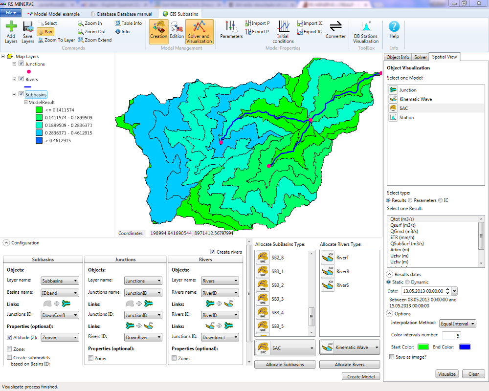
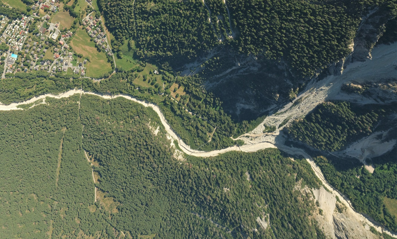
Numerical modeling is an essential tool for estimating hazards, based on historical events and existing environmental data. Depending on requirements and fields of application (such as floods, debris flows, landslides or blockfalls), CREALP provides services based on public software, or applications developed in-house.
- Snowpack and glacier modeling
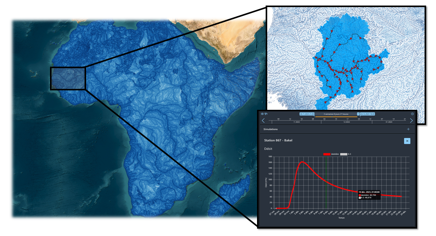
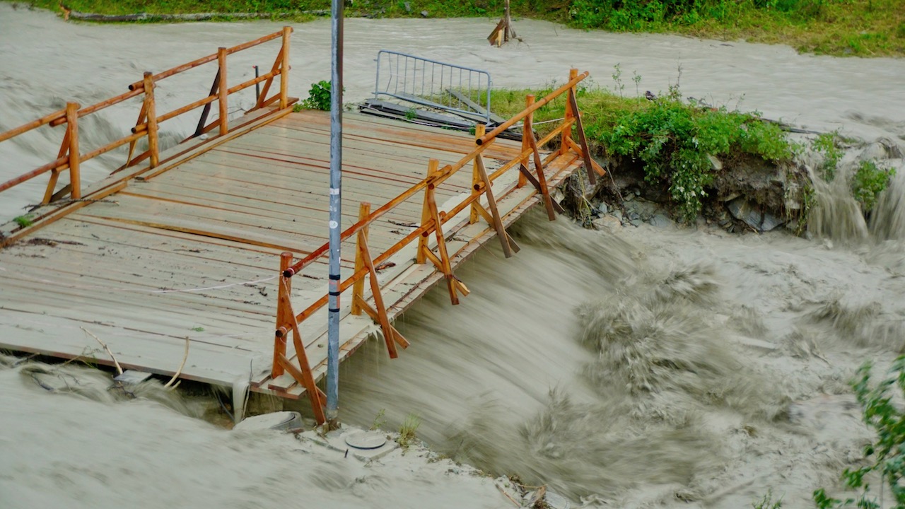
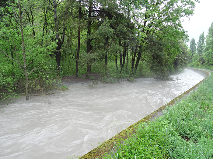
- Hydrological and hydraulic modeling (1D and 2D) / Flood modeling (2D)
- 3D geological models
- Charriage modeling (1D and 2D)
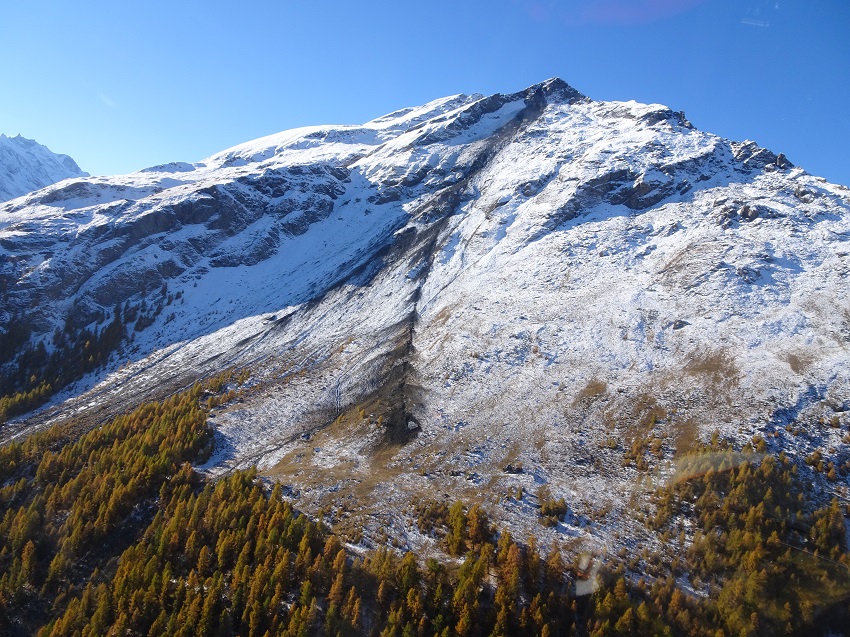
- Modeling of debris flows (2D)
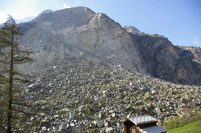
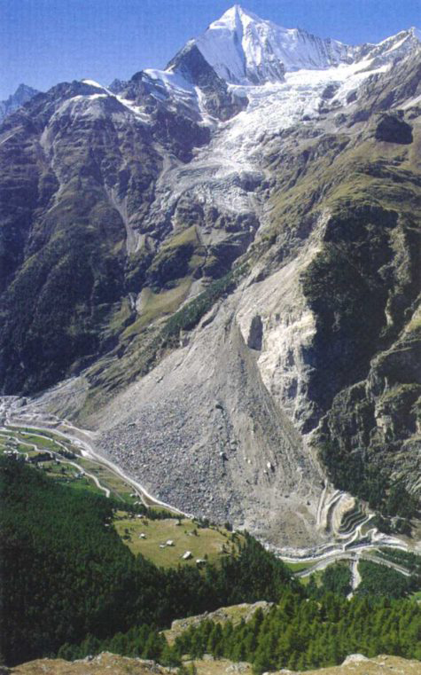
- Rockfall modeling (2D and 3D)

Hazard mapping
Based on event histories and modelling results, hazard maps contain information on hazard types, the extent of areas at risk and the magnitude of the hazard.
These maps are essential for land-use planning, and help define the preventive measures to be implemented to prevent damage. These measures can be physical (protective structures, protective forests, etc.) or organizational (alarm and intervention plans, monitoring and early warning systems).
In this area, CREALP is responsible for the management (control, validation and administration) of hydrological and geological hazard maps for the Canton of Valais.
CREALP also carries out training courses and hazard mapping studies on an ad hoc basis.
Hazard monitoring
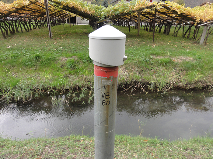
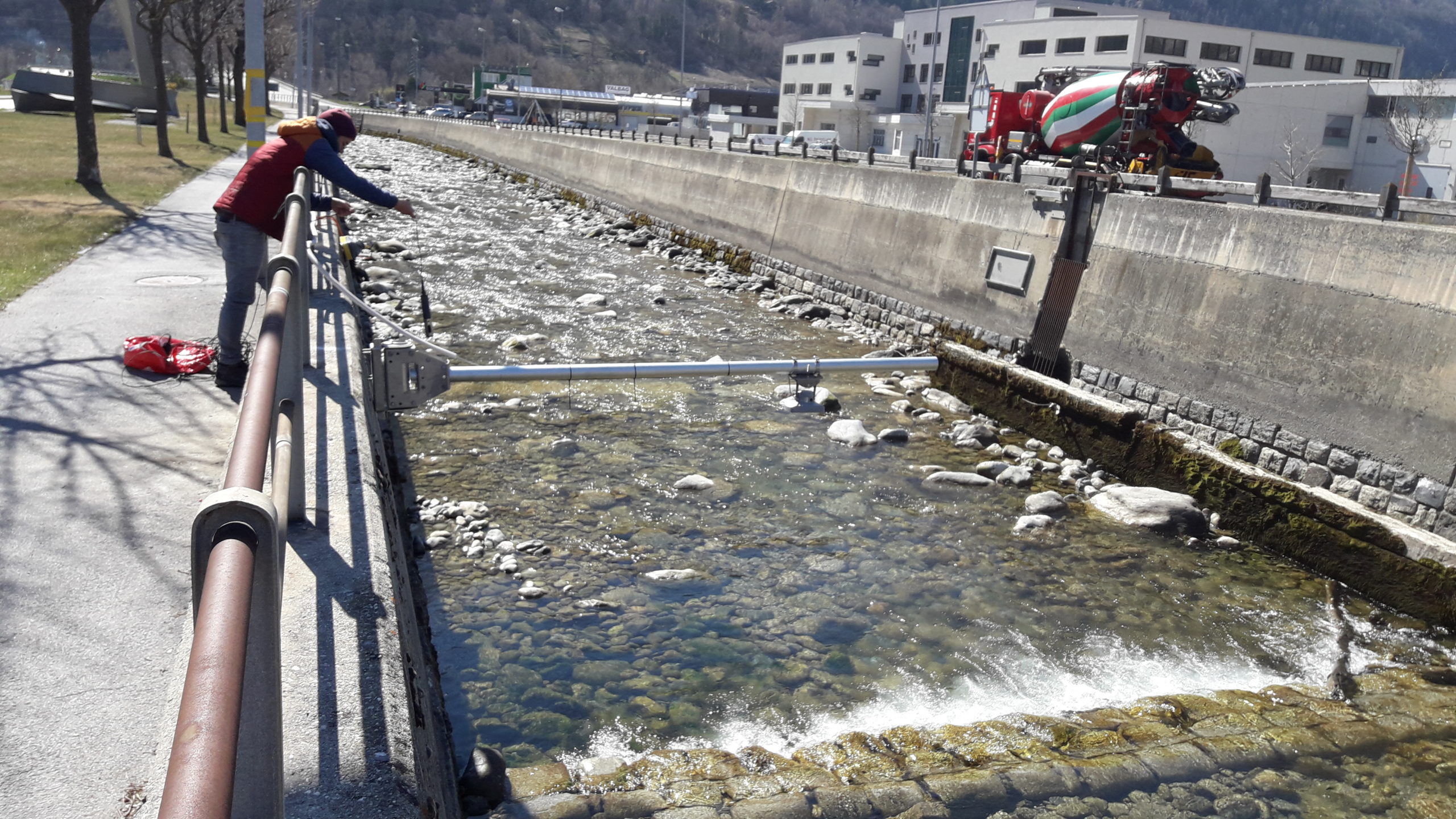
Managing natural hazards requires in-depth knowledge of processes and continuous monitoring of numerous parameters. CREALP is responsible for the installation and maintenance of several measurement networks:
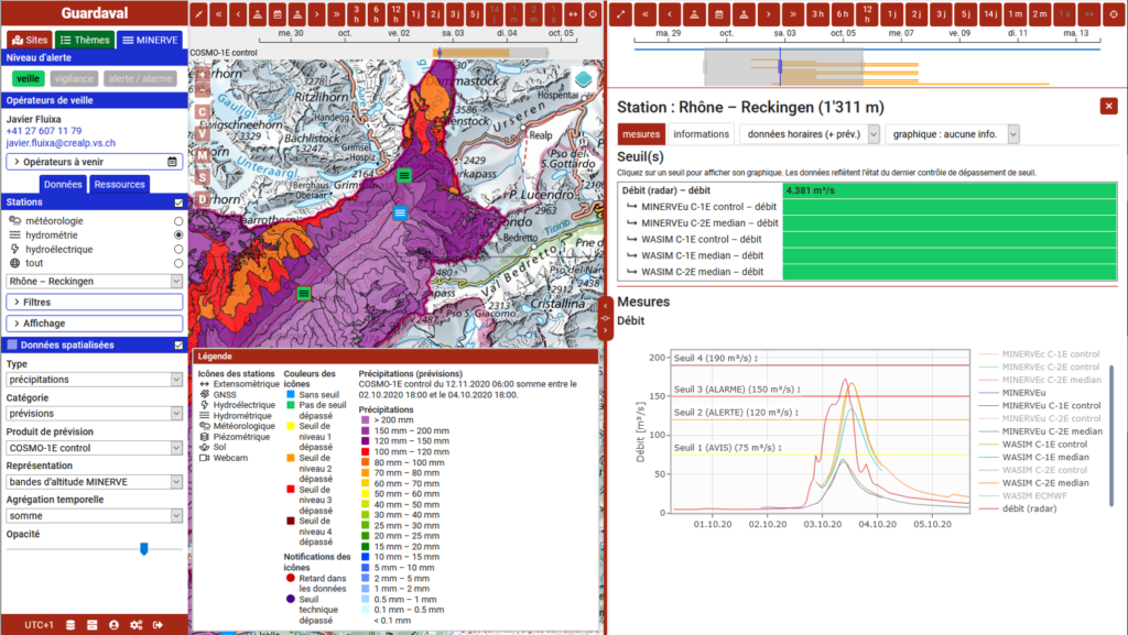
- Networks of hydrometric stations dedicated to alarm and intervention plans and to the MINERVE flood forecasting system.
- Stations dedicated to research and risk management, such as weather stations, snow gauges, webcams or GNSS.
- Networks of piezometric stations for groundwater monitoring.
CREALP also works with data from a number of partner networks, in particular to provide information for GUARDAVAL – the Valaisan platform for monitoring natural hazards.
Early warning systems
Meteorological and hydrological early warning systems are an essential tool in the management of natural hazards, enabling the anticipation of events and the implementation of protective measures.
CREALP has extensive experience in setting up such systems, combining environmental data processing and modeling tools. Today, these systems monitor meteorological events, floods and groundwater levels.
CREALP supports institutions in setting up warning systems and integrating them into crisis management processes. It also provides a standby service to provide scientific support in the event of an event.
