
Numerical hydrogeological models

Numerical hydrogeological models for the third Rhone correction CREALP supports the project managers of the Third Rhone Correction project in analyzing the modeling work carried out by the engineering groups in charge of developing the anticipated and priority measures. The aim is to ensure the best possible quality of prognoses and associated uncertainties, through the use of scientific methods and robust working hypotheses; the model results form the basis for assessing the… Read More
Operational flood forecasting system
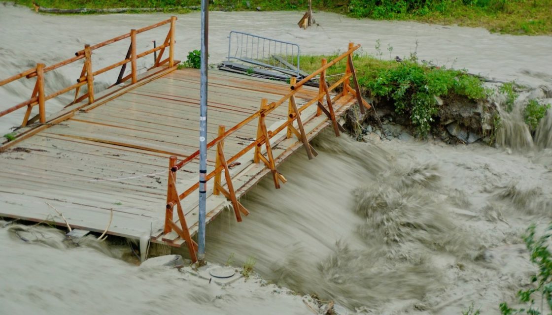
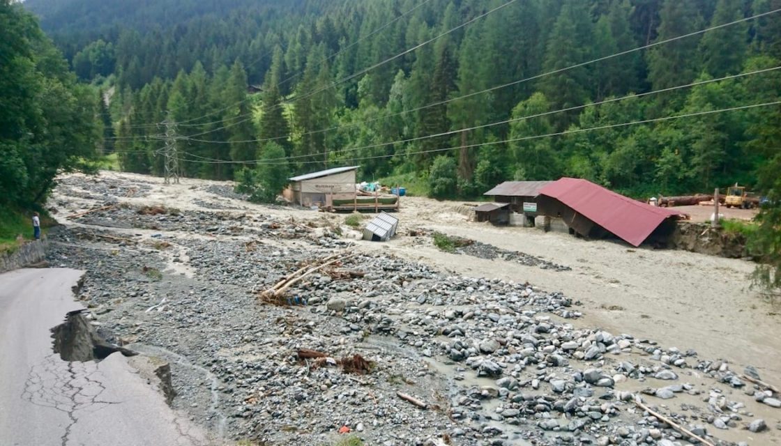
MINERVE: Operational flood forecasting and management system for the Canton of Valais Following the devastating flood of October 2000, the Canton of Valais entrusted CREALP with the development and implementation of a Rhône flood forecasting and management system: the MINERVE system (Modélisation des Intempéries de Nature Extrême du Rhône Valaisan et de leurs Effets). The system has been operational since 2013, and CREALP is responsible for its management and maintenance on behalf… Read More
Groundwater monitoring
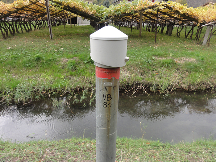
Monitoring groundwater in the Rhône plain and mountain aquifers In Switzerland, groundwater and springs cover more than 80% of water needs. With an annual production of over 1 millionm3, they are the main source of drinking and industrial water. Long-term monitoring of groundwater quality and groundwater levels is therefore of particular importance. This is all the more the case in Valais where, due to the specific nature of the recharge regime for… Read More
INTERREG Italy-Switzerland cooperation > RESERVAQUA project

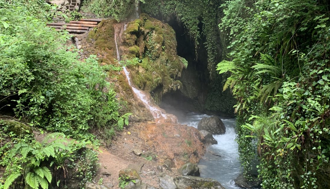
Understanding water resources for better management Water resources in the Alps are under increasing pressure: shortages and deteriorating water quality are just some of the consequences of population growth, the impact of various human activities and climate change. The project is supported by the European Regional Development Fund through the INTERREG V-A Italy-Switzerland cooperation program and the Canton of Valais. Its aim is to assess the factors conditioning the distribution of resources… Read More
Spatial Reference Information System | Geological Hazards
A Spatially Referenced Information System for managing geological hazards in the canton of Valais SIRS-DAGEO is one of the spatially referenced information systems (SIRS) set up by the canton of Valais to optimize the use and development of information contained in natural hazard studies (avalanches, floods, ground instabilities). SIRS-DAGEO records information relating to geological hazards. Launched by the canton of Valais in 2004, SIRS-DAGEO enables data from geological hazard studies to be… Read More
Thermal balance of the water table
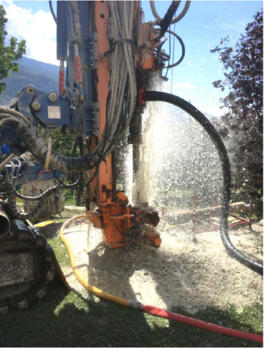
Inventory of groundwater use for heating and cooling in Sion, implementation of a temperature monitoring network. Groundwater is an important energy resource. It can be used to generate heat and cooling throughout the year. The groundwater table in the Rhône plain is often the focus of particular attention from planners, due to its high exploitation potential and proximity to the surface. There are around 150 installations in operation in the Sion area…. Read More
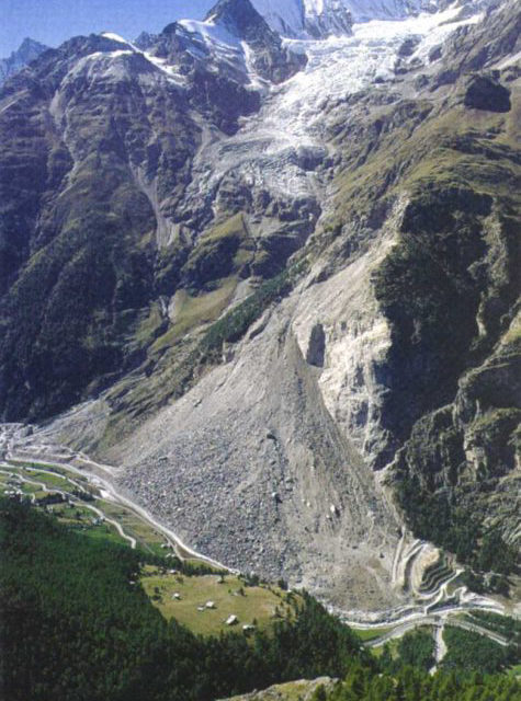
Geothermal potential in Valais (GEOTHERMOVAL II)
Geothermal potential of high-permeability conduits at the base of the glacial Rhone valley in Valais The aim of the Géothermoval II project, which follows on from the GEOTHERMOVAL project, is to estimate the geothermal potential of the Rhône valley in order to determine whether this resource can be exploited to meet the growing energy needs arising from the densification of lowland regions. In order to identify areas of interest for geothermal drilling,… Read More
DEEP CITY Verbier
Understanding water resources for better management CREALP is involved in applying the Deep City method (Parriaux et al. 2010) to the Verbier region on behalf of the Val de Bagnes municipality. This method was developed based on the observation that, on a commune scale, underground space is limited and a source of both conflicts (of use) and synergies (geomaterials). This approach aims to popularize and map complex geological complexes in order to… Read More
PhD: Real-time data assimilation for flood forecasting
Real-time data assimilation for hydrological modeling and flood forecasting in managed Alpine catch ments (Alain Foehn thesis) The research project “Real-time data assimilation for hydrological modelling and flood forecasting in equipped alpine catchments” is part of the MINERVE cantonal system for flood forecasting and management in Valais. This thesis project is supervised by EPFL’s Laboratoire de Constructions Hydrauliques(LCH) and funded by CREALP. Also conducted in partnership with the Canton of Valais, MétéoSuissse,… Read More
International cooperation > Flood forecasting (Ecuador)
Development of a hydrological forecasting system in Ecuador CREALP supported INAMHI, the technical-scientific entity responsible for the production and dissemination of hydrometeorological information in Ecuador, in the design of a simulation model and the development of an automatic real-time forecasting system. The support provided consisted of a training course in hydrology using the RS MINERVE software, as well as technical support for the development of a model of the Coca watershed. This… Read More