
HyFORS
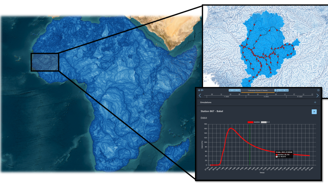
Hydrological Forecasting Online with Routing System HyFORS is a cloud platform that makes the adoption of operational hydrological/hydraulic forecasting systems accessible anywhere in the world with limited resources. By using global weather datasets and automating the creation and deployment of a complex operational system on Google Cloud Platform, this solution will help reduce hydrological risks and better manage water resources. A plug-and-play cloud platform for global flood forecasting In its 2022 Global… Read More
Flood hazard maps (Cameroon)
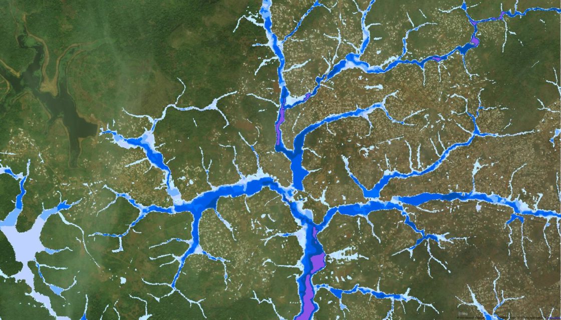
Flood hazard mapping for cities in Cameroon CREALP took part in the “Building Capacity for Resilient Urban Development and Integrating Climate and Disaster Risk Considerations into Urban Planning” project managed by the World Bank. The aim of the project was to contribute to increasing the resilience of Cameroon’s cities to the risk of flooding by drawing up hazard maps to enable better planning of urban development, taking into account the risks to… Read More
Charriage + seismic sensors

SismoRiv project: Development of a charriage measurement system based on low-cost seismic sensors The aim of this project, which is dedicated to the issue of sediment transport, is to develop a measurement method that is simple to install and use, effective and considerably less costly for the various players involved (developers, risk managers, cantonal and municipal services). The monitoring of solid transport by watercourses is indeed of great economic and ecological importance…. Read More
Spatial Reference Information System | Floods
A Spatially Referenced Information System for managing hydrological hazards in the canton of Valais SIRS-CRUES is one of a series of spatially referenced information systems (SIRS) set up by the canton of Valais to optimize the use and enhancement of information contained in natural hazard studies (avalanches, floods, ground instabilities). SIRS-CRUES records information relating to hydrological hazards. Developed on the initiative of the Natural Hazards Service(SDANA) and with the collaboration of the… Read More
Exceptional and extreme floods (CRUEX ++)
A methodology for estimating exceptional and extreme floods in Switzerland The CRUEX++ “Exceptional and Extreme Floods” research project follows on from the CRUEX project, which in 2001 proposed a preliminary methodology of the PMP-PMF (Probable Maximum Precipitation-Probable Maximum Flood) type: a methodology for estimating extreme floods capable of integrating the hydrological particularities of the Alpine environment. As the quantitative estimation of extreme floods is still a poorly understood issue, this new project… Read More
RS MINERVE software
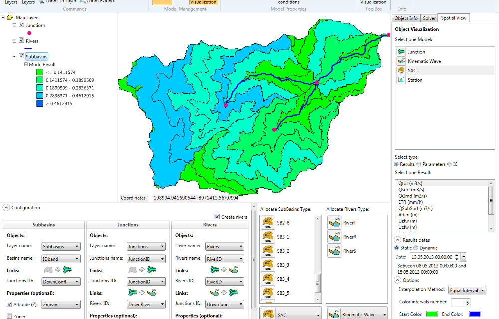
Modeling hydrological and hydraulic networks using a semi-distributed approach PRESENTATION RS MINERVE is a hydrological and hydraulic modeling software package that simulates rainfall-runoff transformations and free-surface flows. The software is capable of representing not only the main hydrological processes such as snowmelt, glacial melt and surface and subsurface flows, but also regulated structures such as reservoirs, gates, spillways, water intakes, turbines or pumps, and other hydraulic structures. Comprehensive analysis of a hydrological-hydraulic… Read More
Operational flood forecasting system
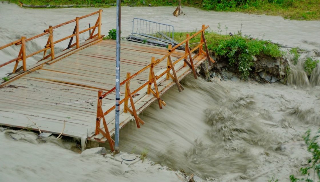
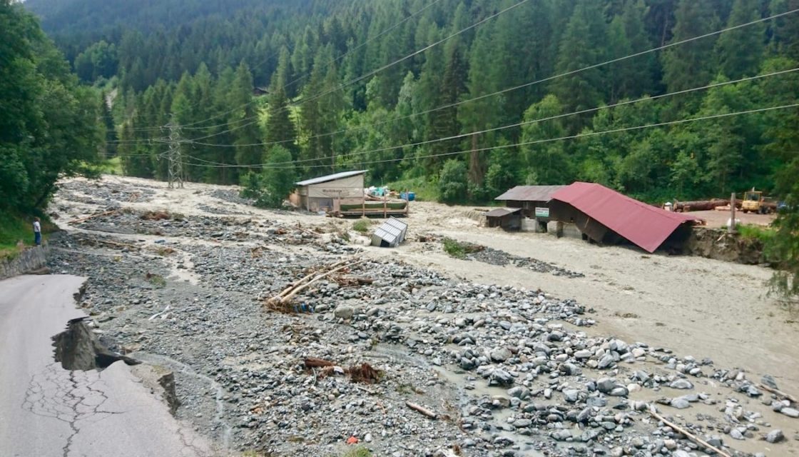
MINERVE: Operational flood forecasting and management system for the Canton of Valais Following the devastating flood of October 2000, the Canton of Valais entrusted CREALP with the development and implementation of a Rhône flood forecasting and management system: the MINERVE system (Modélisation des Intempéries de Nature Extrême du Rhône Valaisan et de leurs Effets). The system has been operational since 2013, and CREALP is responsible for its management and maintenance on behalf… Read More
PhD: Real-time data assimilation for flood forecasting
Real-time data assimilation for hydrological modeling and flood forecasting in managed Alpine catch ments (Alain Foehn thesis) The research project “Real-time data assimilation for hydrological modelling and flood forecasting in equipped alpine catchments” is part of the MINERVE cantonal system for flood forecasting and management in Valais. This thesis project is supervised by EPFL’s Laboratoire de Constructions Hydrauliques(LCH) and funded by CREALP. Also conducted in partnership with the Canton of Valais, MétéoSuissse,… Read More
International cooperation > Flood forecasting (Ecuador)
Development of a hydrological forecasting system in Ecuador CREALP supported INAMHI, the technical-scientific entity responsible for the production and dissemination of hydrometeorological information in Ecuador, in the design of a simulation model and the development of an automatic real-time forecasting system. The support provided consisted of a training course in hydrology using the RS MINERVE software, as well as technical support for the development of a model of the Coca watershed. This… Read More
Adapting to climate change (Peru)
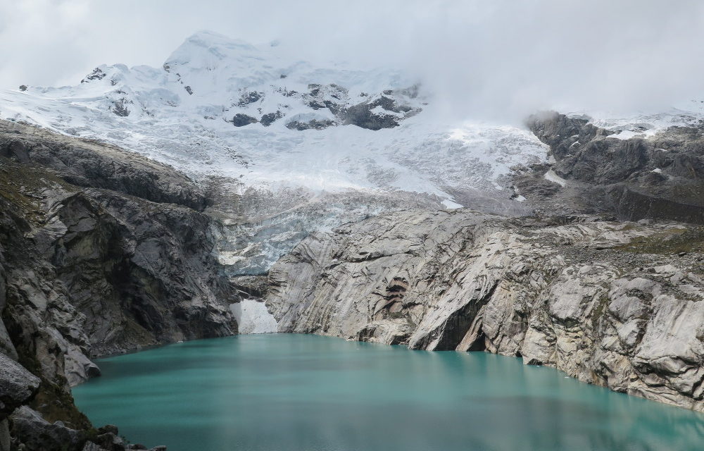
Adapting to climate change and reducing the risks associated with glacial retreat in the Andes – Peru The Glacier 513 project was a multi-objective project designed to reduce the risks associated with the retreat of Glacier 513 (Peru), and to optimize water resource management for its entire watershed. Located in the Ancash region of Peru’s Cordillera Blanca, Glacier 513 lies upstream of the Chucchún basin and threatens the city of Carhuaz. In… Read More