
WATERWISE
Co-designing sustainable management solutions for resilient Alpine headwaters Climate change and human pressures are having an increasing impact on alpine waters, the main sources of freshwater in the Alpine Space. Significant alterations in water availability and quality pose significant challenges to Alpine communities and have profound implications for the ecosystem services on which they depend. WATERWISE involves 12 project partners from France, Italy, Switzerland, Germany, Austria and Slovenia. This project aims to… Read More
HyFORS
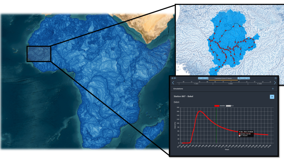
Hydrological Forecasting Online with Routing System HyFORS is a cloud platform that makes the adoption of operational hydrological/hydraulic forecasting systems accessible anywhere in the world with limited resources. By using global weather datasets and automating the creation and deployment of a complex operational system on Google Cloud Platform, this solution will help reduce hydrological risks and better manage water resources. A plug-and-play cloud platform for global flood forecasting In its 2022 Global… Read More
Debris flow warning system (SALT)
Real-time operational warning system for debris flow forecasting in Valais The aim of the Système d’Alerte de Laves Torrentielles (SALT) project is to set up a meteorological warning system for selected sites throughout the canton of Valais. These areas have been affected by numerous debris flow events in the past, which is why a real-time warning system project has been initiated to prevent such events in the future. This system enables SMS… Read More
GEOTHERMOVAL project
Inventory of the hydrothermal capacities of the Canton of Valais through the study of resurgent hydrothermal springs Initiated in 1988, the GEOTHERMOVAL program was designed to research, evaluate and develop potential geothermal resources in the canton of Valais as an alternative energy source, in particular for space heating and domestic hot water. This geothermal prospecting program was carried out by the CRSFA (Centre de Recherches Scientifiques Fondamentales et Appliquées de Sion, formerly… Read More
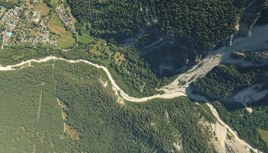
Randa rockfall (1991)
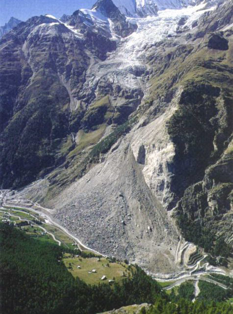
The data collected on this site has been an essential source of knowledge for analyzing the behavior of the Grossgufer massif and managing the associated risks. Preamble In the spring of 1991, the village of Randa in the Mattertal valley, some 5 km downstream of Zermatt, was the scene of one of the largest rockfalls in Europe in the 20th century, along with that of Val Pola (Valtelline, Italy, 1987). In all,… Read More
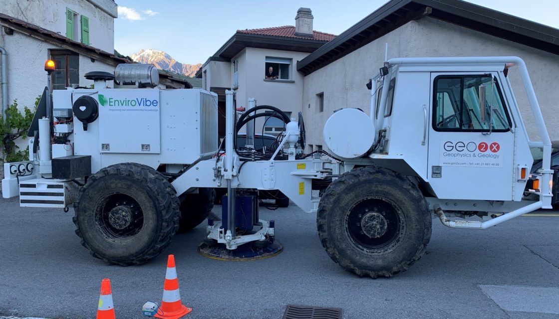
Matterock methodology
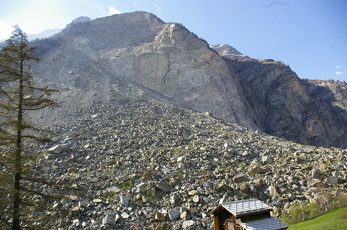
A methodology for monitoring cliffs and detecting potential major landslides The major rockfall at Randa (Valais, Switzerland) in the spring of 1991 (30 Mom3) highlighted the scientific shortcomings in predicting such catastrophic events. It was therefore decided to develop a cliff monitoring methodology that would provide a better understanding of the phenomenon of cliff instability and anticipate potential rockfalls. This methodology, called MATTEROCK, was developed as part of the National Research Program… Read More
ToolMap
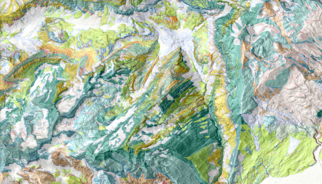
Modelling, vectorization and export of geological information in GIS format Presentation ToolMap is a software for modelling, vectorizing and exporting information in GIS form. It is designed to support the practitioner in the various phases of creating a complex GIS. It was originally developed to facilitate the vectorization of geological maps, but its scope of application is much wider. For example, it can be a valuable tool for the creation of natural… Read More
WATER – IS IT OBVIOUS?

Exhibition as part of the INTERREG RESERVAQUA project The result of a collaboration between CREALP, the Valais Environment Department and the Alpine House Foundation, the exhibition on water and its climatic challenges presented at the Centre de Géologie et Glaciologie in Les Haudères in the Val d’Hérens was closely linked to the cross-border cooperation project between Switzerland and Italy, entitled “RESERVAQUA – knowing water resources for better management (2019-2023)”. Its primary objective… Read More
Rhône Festival
35th Rhône Festival from September 5 to 8, 2024 PROJECT BACKGROUND: The Fêtes du Rhône tell the story of a long history of friendship between France and Switzerland. In the towns along the river, they brought together a fervent community around a popular festival, cultural events and a congress. The committee hopes to use the occasion of these celebrations to create a federative action that will last for years to come. A… Read More
Flood hazard maps (Cameroon)
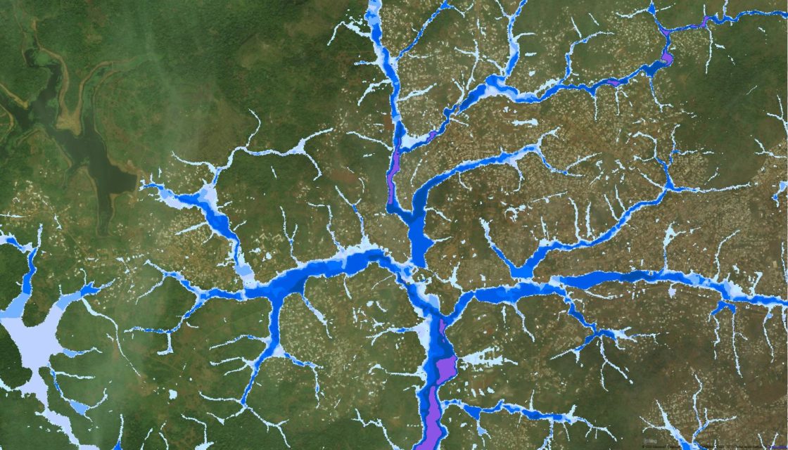
Flood hazard mapping for cities in Cameroon CREALP took part in the “Building Capacity for Resilient Urban Development and Integrating Climate and Disaster Risk Considerations into Urban Planning” project managed by the World Bank. The aim of the project was to contribute to increasing the resilience of Cameroon’s cities to the risk of flooding by drawing up hazard maps to enable better planning of urban development, taking into account the risks to… Read More