
Dangerous glaciers in Valais
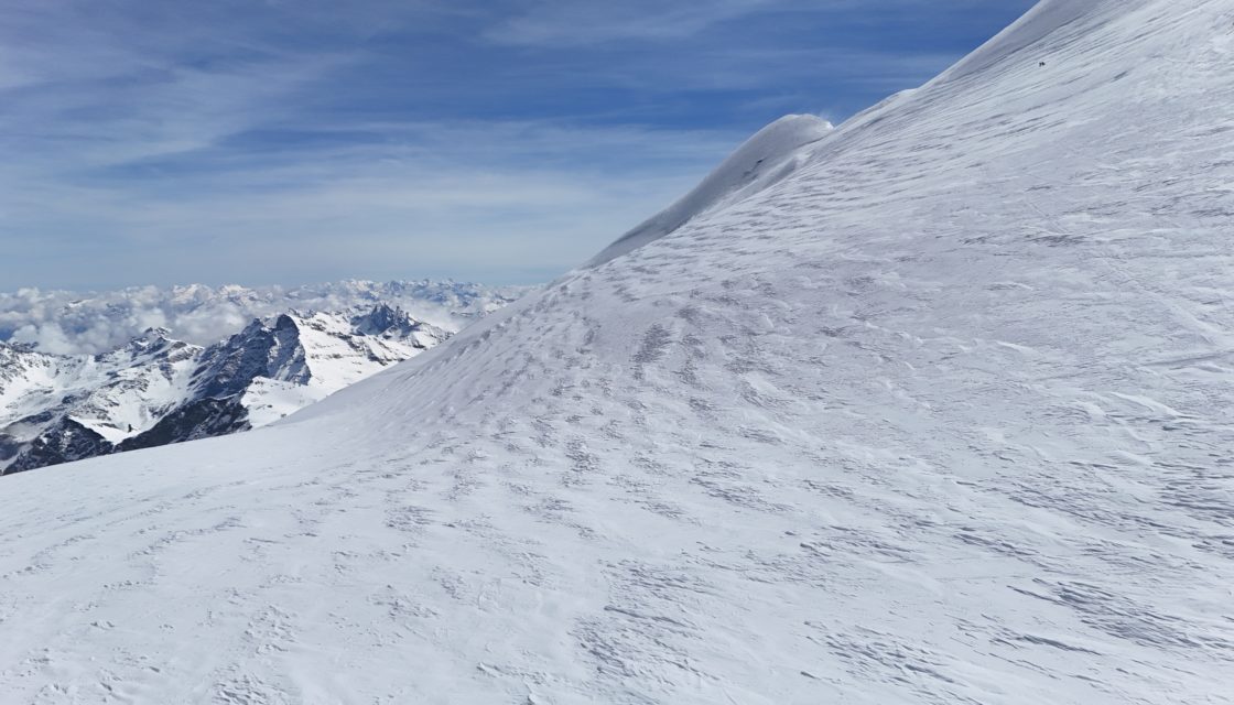
Monitoring and inventory of dangerous glaciers in the canton As part of the GL² consortium, comprising CREALP and geoformer igp AG, the Canton of Valais has commissioned us to update and monitor the canton’s inventory of hazardous glaciers. This inventory is an essential tool for identifying and assessing natural hazards linked to the rapid changes in glaciers in the context of climate change. To date, around fifty glaciers are included in this… Read More
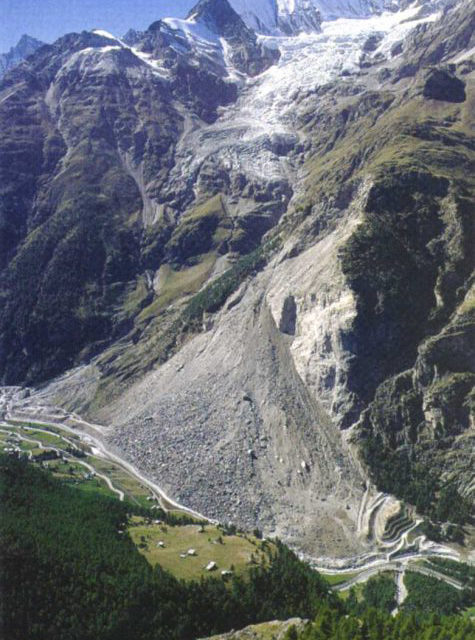
Matterock methodology
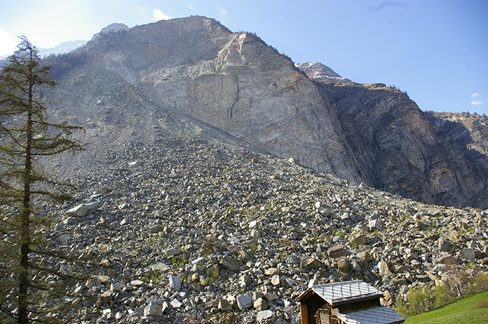
A methodology for monitoring cliffs and detecting potential major landslides The major rockfall at Randa (Valais, Switzerland) in the spring of 1991 (30 Mom3) highlighted the scientific shortcomings in predicting such catastrophic events. It was therefore decided to develop a cliff monitoring methodology that would provide a better understanding of the phenomenon of cliff instability and anticipate potential rockfalls. This methodology, called MATTEROCK, was developed as part of the National Research Program… Read More
GUARDAVAL monitoring system
The Canton of Valais natural hazard monitoring portal Guardaval is a comprehensive IT platform for operational and synoptic monitoring of natural hazards (ground instabilities, floods, glacial hazards, meteorological hazards, debris flows, etc.) in the Valais. For over 20 years, CREALP has been maintaining and developing this constantly evolving platform for the State of Valais, integrating more data and functionalities every day. Today, Guardaval integrates more than 70 data sources from different suppliers… Read More
Spatial Reference Information System | Floods
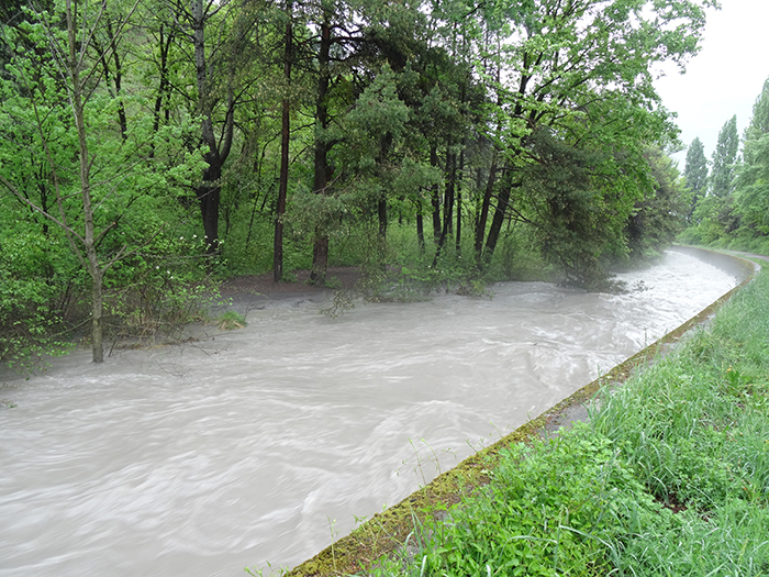
A Spatially Referenced Information System for managing hydrological hazards in the canton of Valais SIRS-CRUES is one of a series of spatially referenced information systems (SIRS) set up by the canton of Valais to optimize the use and enhancement of information contained in natural hazard studies (avalanches, floods, ground instabilities). SIRS-CRUES records information relating to hydrological hazards. Developed on the initiative of the Natural Hazards Service(SDANA) and with the collaboration of the… Read More
Spatial Reference Information System | Geological Hazards
A Spatially Referenced Information System for managing geological hazards in the canton of Valais SIRS-DAGEO is one of the spatially referenced information systems (SIRS) set up by the canton of Valais to optimize the use and development of information contained in natural hazard studies (avalanches, floods, ground instabilities). SIRS-DAGEO records information relating to geological hazards. Launched by the canton of Valais in 2004, SIRS-DAGEO enables data from geological hazard studies to be… Read More