Geo-resources
Sustainable, integrated management of natural resources such as groundwater, surface water and subsoil requires in-depth knowledge of local and regional conditions.
This knowledge is based on relevant and coherent basic data, as well as on CREALP’s multiple skills in order to enhance them, whether in terms of access to information, the development of decision-making tools (indicators, maps, web portals, etc.), or the modeling of complex processes.
Our common interest is to preserve these resources by using them rationally through planning measures and by anticipating future developments, in terms of climate change and the region’s socio-economic development.
Our services in geo-resources
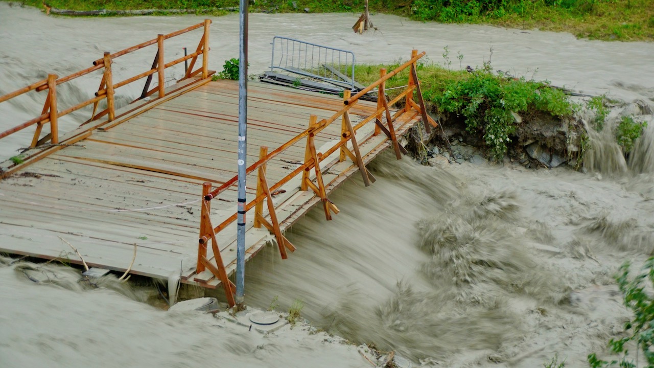
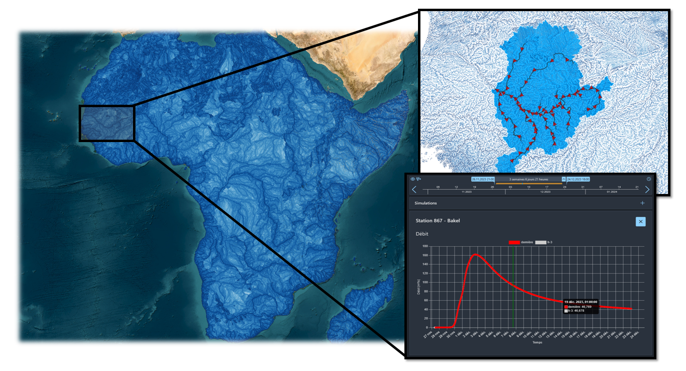
Water and climate change
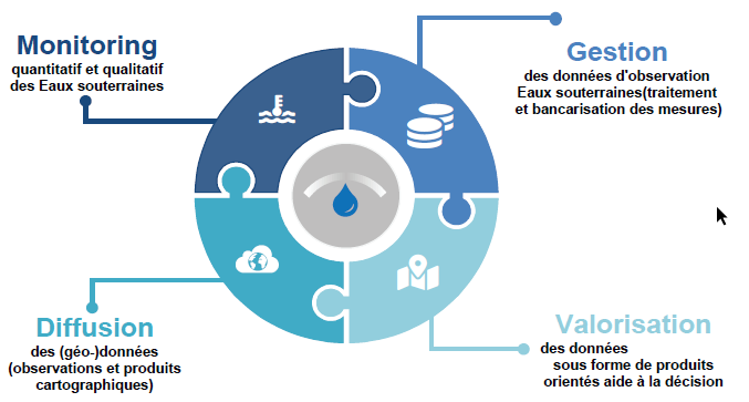
CREALP supports public authorities and private partners in defining strategies for the sustainable management of water resources in the context of climate change. The aim is to develop and make available new tools to ensure current and future security, in terms of both quantity and quality, for the multiple uses of water (drinking water, irrigation, hydroelectricity, vital spaces, etc.).
Documents


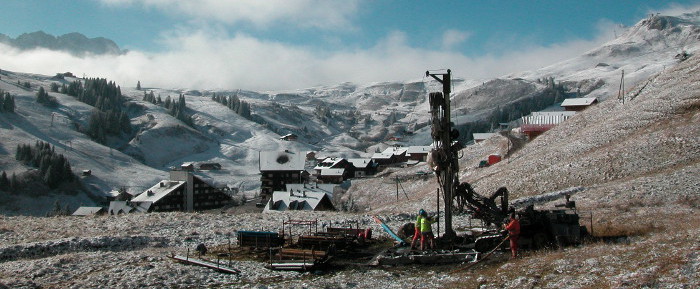
Geothermal
Geothermal energy is a heat source supported by the Swiss Confederation and cantons as part of the energy transition. It emits noCO2, is independent of climatic conditions and guarantees a sustainable, constant supply. CREALP develops projects to enhance the hydrothermal heritage of Alpine environments, and assists with the integrated management of groundwater thermal exploitation facilities such as the one on the Rhône plain.
Documents

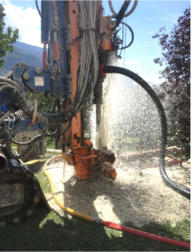

Hydrogeological studies
Hydrogeology is a complex field that requires expertise to understand certain processes. These expert assessments are carried out by hydrogeologists with advanced skills (PhD, post-doc) and local knowledge. They are based on relevant and robust basic data.
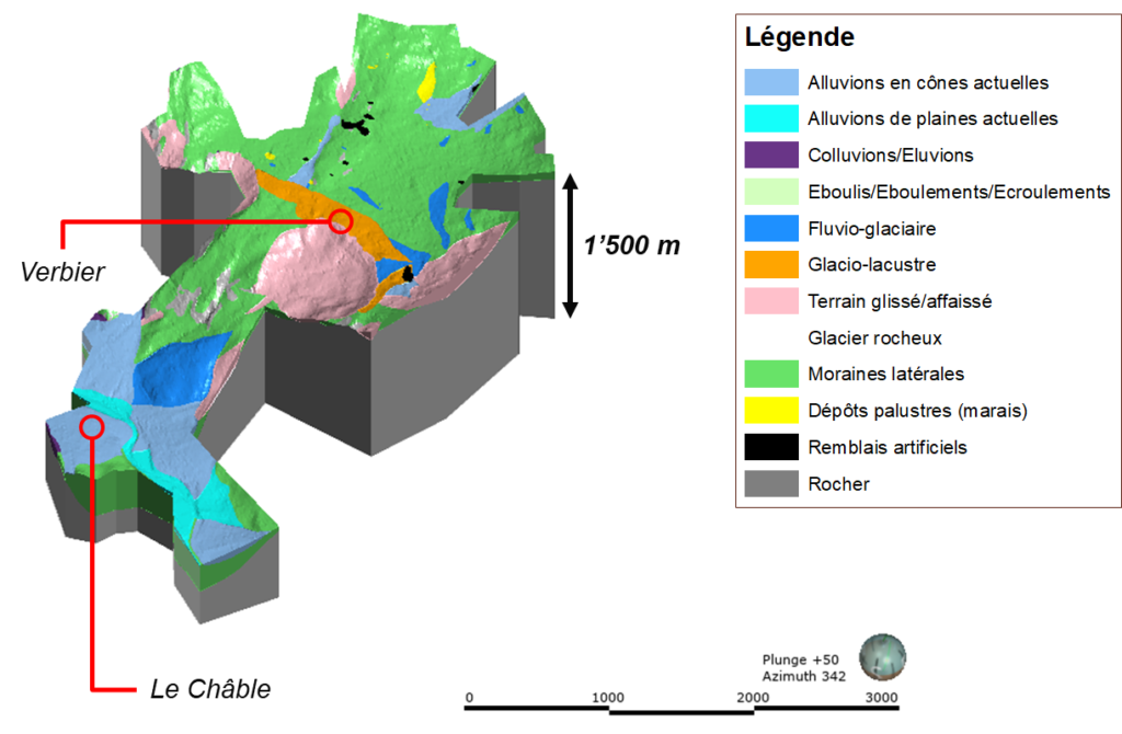


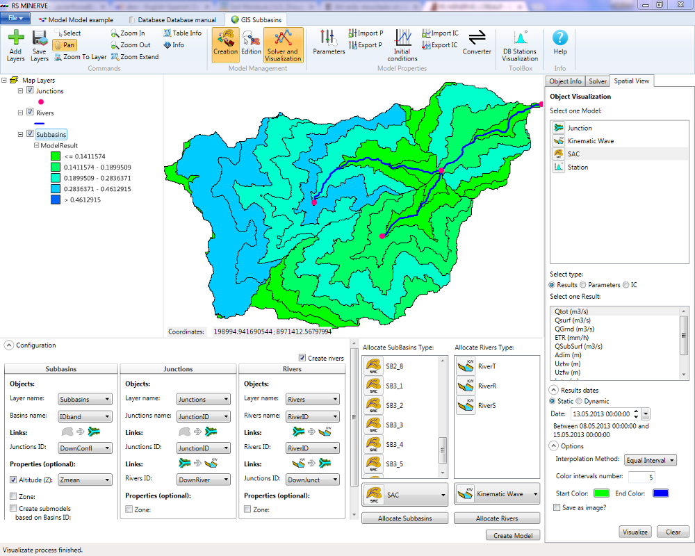
Hydrogeological modeling
CREALP supports local authorities and other stakeholders in identifying and understanding complex hydrogeological processes at different scales, and in understanding exchanges between surface water and groundwater. Conceptual groundwater flow models provide a solid basis for the development of numerical hydrogeological models. These models can be used to reproduce current situations and to make forecasts following environmental disturbances (major construction projects, new water catchments, pollution, etc.). Sensitivity and uncertainty analyses complement prognoses to assess potential risks in relation to local issues.
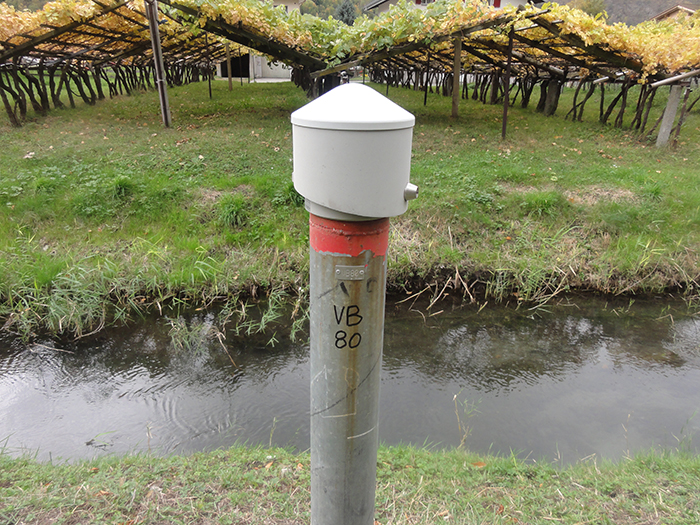
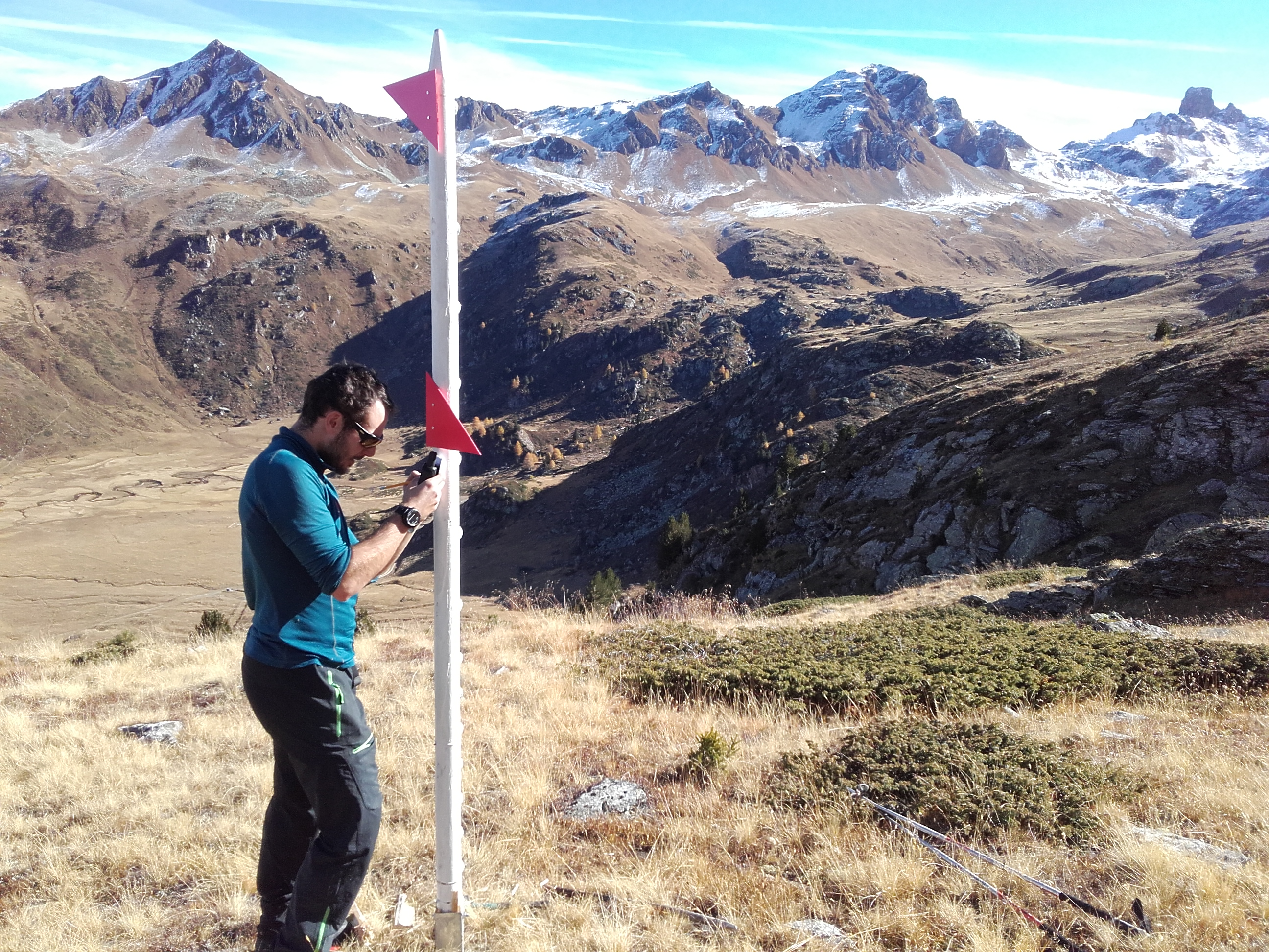
Groundwater monitoring
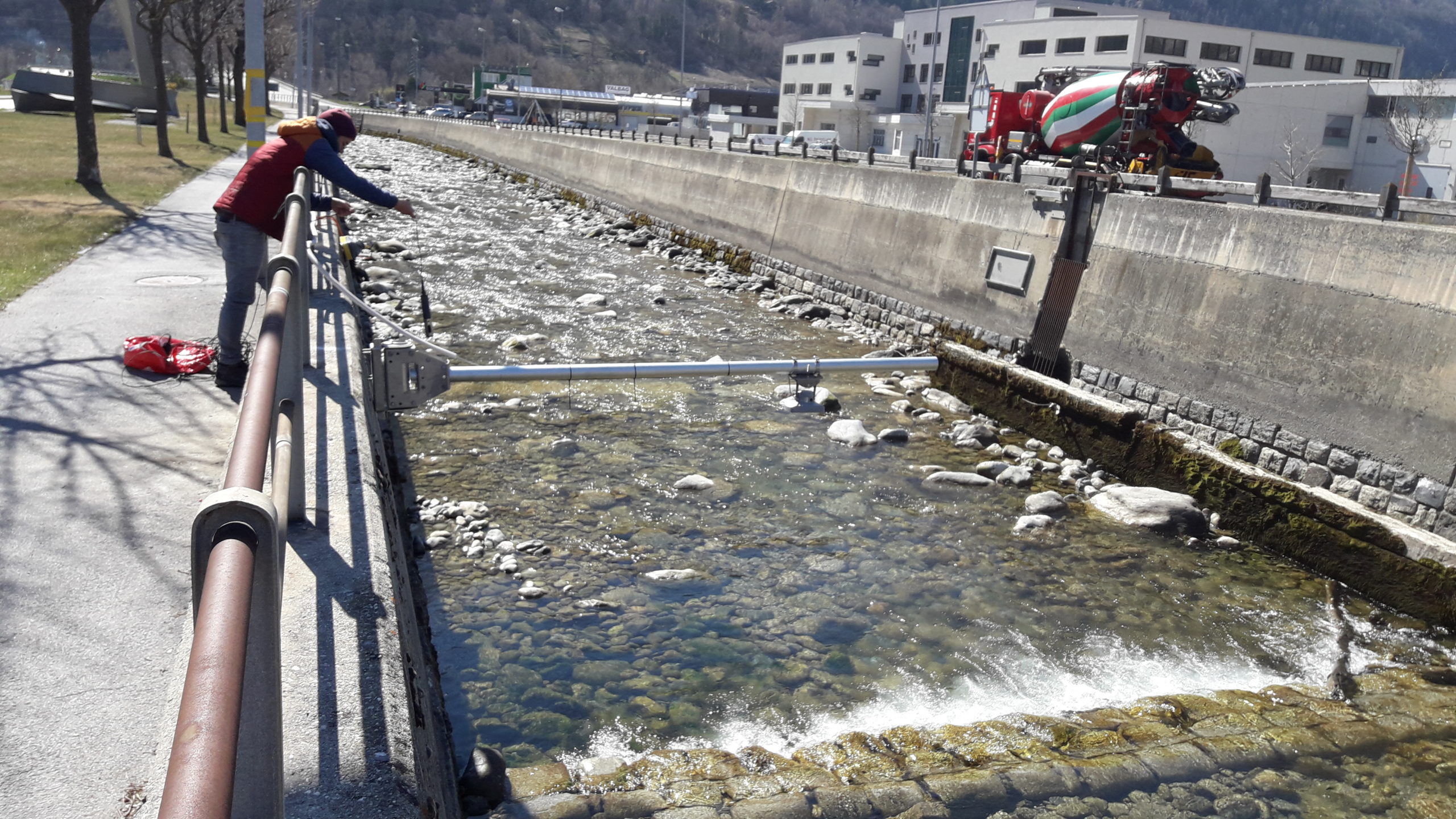
In practice, groundwater protection is directly dependent on the knowledge acquired through observation and monitoring. In this field, CREALP has been actively involved for over 20 years in implementing and consolidating the various processes involved in groundwater monitoring (groundwater, mountain springs) and subsurface data management (boreholes).